Cargando...
Recursos educativos
-
Nivel educativo
-
Competencias
-
Tipología
-
Idioma
-
Tipo de medio
-
Tipo de actividad
-
Destinatarios
-
Tipo de audiencia
-
Creador
Lo más buscado
-

Analyse. World economic powers
EduBook Organización
- 2838 visitas
Look at the map and do the activities: Name the main world economic and military powers. Which continent do you think holds the most power? Give three reasons why you think this is so. Which group does…
-

Analyse. Transport in the European Union
EduBook Organización
- 2777 visitas
Look at the map and answer the questions: Which countries have a high-speed rail network? What advantages do you think high-speed rail offers the European Union? What are the most important ports in the…
-

Webquest: Exploring the world
Tiching explorer Organización
- 4910 visitas
In this webquest we find out about different countries of the world. We do an online research. We work in groups in order to write a report on the country that includes a title page, outline,…
-

Identify. Spain's relief and hydrography 03
EduBook Organización
- 2763 visitas
To find out more about Spain's geographical features, you can visit this web page: http://www.tiching.com/66142 Look at the map and answer the questions : Which mountains border the Meseta? What…
-

-

The 25 European Union Countries
INTEF Organización
- 1 lo usan
- 4644 visitas
With this unit and a map students learn to identify E.U. countries and their capital cities. They can read a text to extract specific information. We focus on the 17 Spanish autonomous Communities, on…
-

Analyse. Industry around the world
EduBook Organización
- 2741 visitas
Look at the map and do the activities: In which countries are the world's largest industrial areas? Which continents are the least industrialised? Where is industry mostly concentrated on each…
-

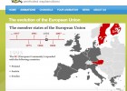
The Evolution of the European Union
Tiching explorer Organización
- 4683 visitas
This interactive map of Europe shows the evolution of the European Union (EU) over the years, since 1957 until 2007. The info graphic indicates when the various member states joined, if we drag the…
-

Average annual rainfall
EduBook Organización
- 2700 visitas
Precipitation maps have imaginary lines called isohyets. The isohyets connect places on the Earth's surface with the same amount of precipitation. The map shows how: Precipitation is abundant in…
-

Answer. Calculate distances
EduBook Organización
- 2687 visitas
Note the distance (in km) between two points on a map separated by...: 2 cm at a scale of 1: 1 000: km 4 cm at a scale of 1: 1 000 000: km 6.8 cm at a scale of 1: 25 000: km 5,9 cm at a scale of 1: 50…
Te estamos redirigiendo a la ficha del libro...


